


Track: Derwent Edge
Derwent Edge is a bridleway near Ladybower, Derwent in the Peak District, UK. This page is intended to provide information for mountain biking on the track, although some descriptions and images may have become outdated (see image dates).
Rating: Technical / Speed / Fun:  | |
| |
Height Descent / Distance: 160m / 2.33km
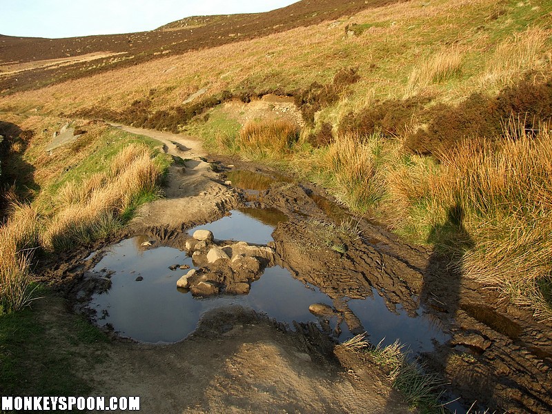
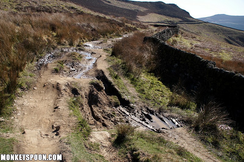
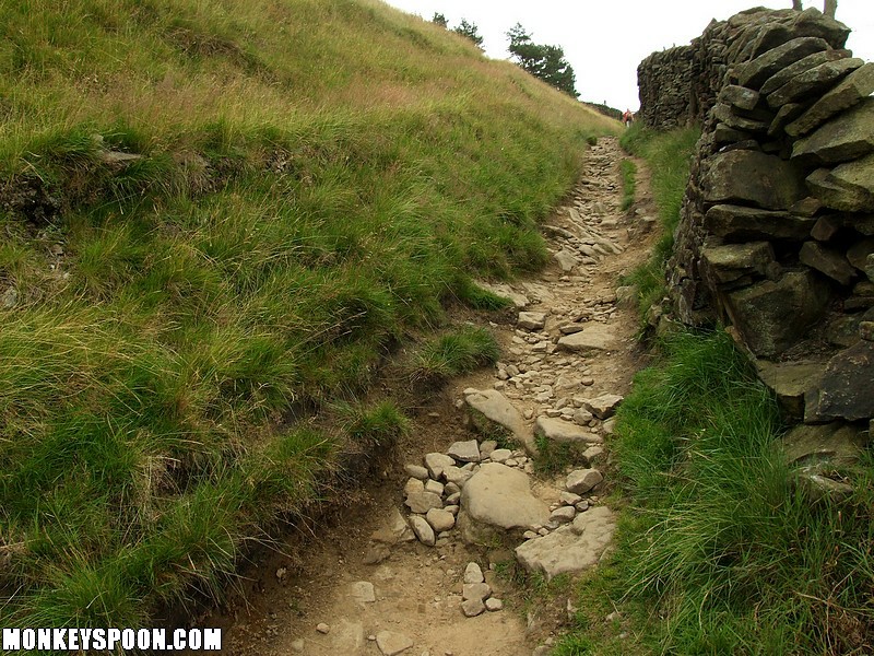
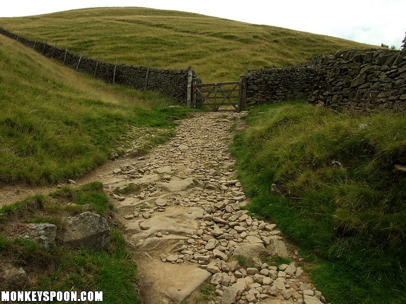
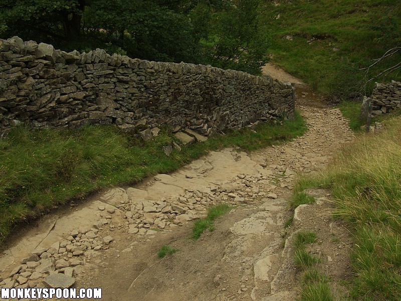
Surface: Dirt, peat, and clay on the upper sections, small to medium gritstone rocks and bedrock on the lower middle section, flag stones across the last field.
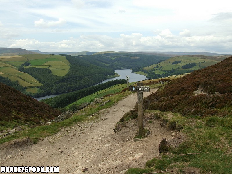
Location: SK 195 880 - Bing OS Map (Desktop only) - Google Aerial Map
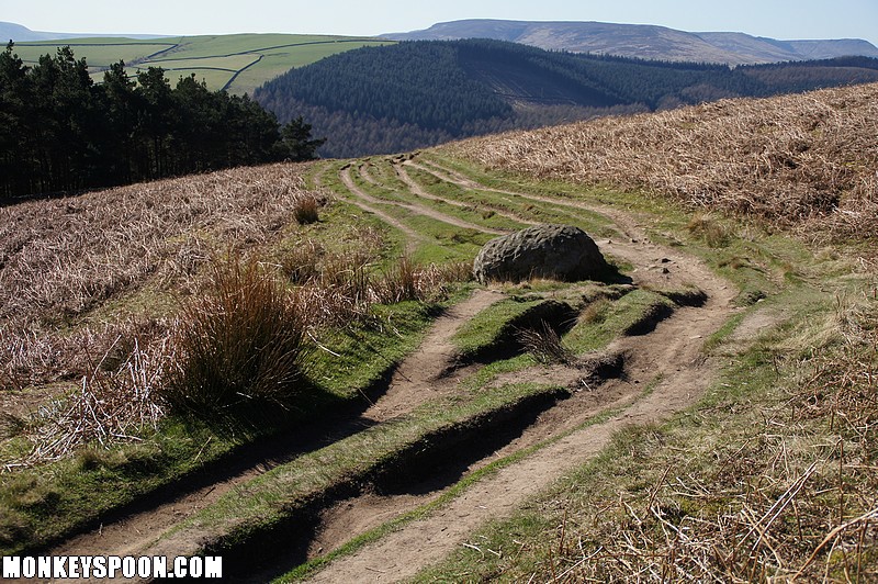
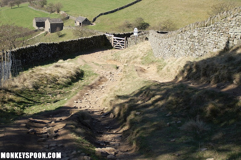
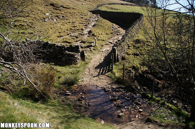
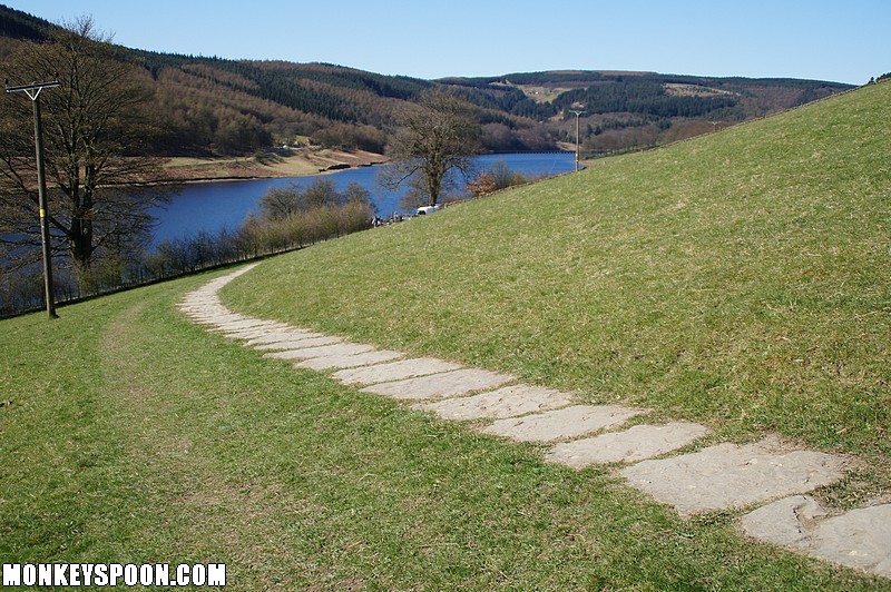
The bridleway below Derwent Edge, between Whinstone Lee Tor and Grindle Clough, near Ladybower and Derwent. Starting from the junction at Whinstone Lee Tor it heads north down a slight incline before curving with the contours for a kilometre. It then turns west and gets a decent slope as it drops down into Grindle Clough, after the shelter comes the steepest section before, it joins the bridleway on gravel & dirt track on the north east side of the top fork of the Ladybower Reservoir.
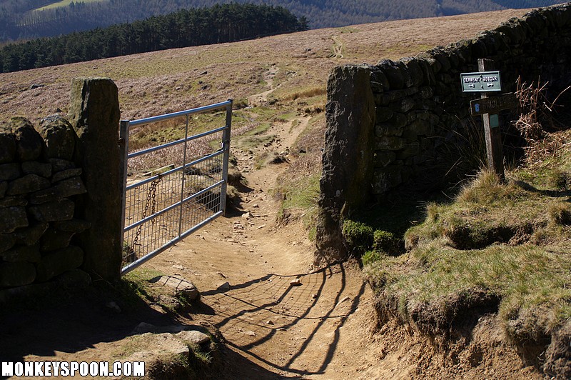
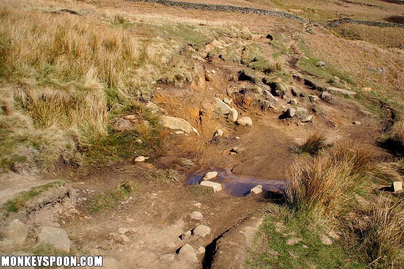
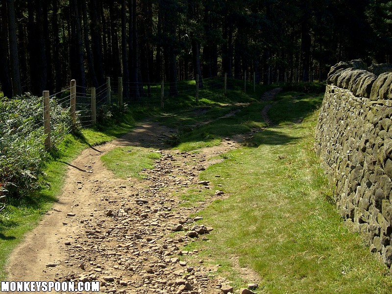
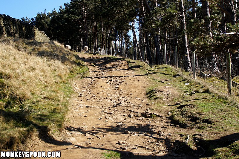
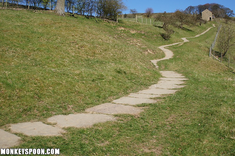
After the first short descent, watch out for peddle clipping rocks. The bridleway flattens out to a narrow track with short sections of narrow lines mixed in between streams and all year around puddles/bogs If you pick the right line it is possible to complete these section without putting your feet down. Some of these puddles are deceptively deep so if you are unsure check before riding straight in. After a Kilometre you will reach a gate, at this point the bridleway turns to the left and the gradient increases. With the first decent being rocky and quite fast, the track then becomes confined to a number of narrow singletrack lines after a stream crossing and a short incline the narrow lines continue down to a gate. Now with a wood on the left the gradient further increases as the bridleway descends between the edge of the woods and a dry stone wall on the right. With many different narrow lines to pick between all of similar technicality. After passing through another gate the bridleway get narrow and continues for a short distance down a gully, watch out for rocks in the base and side of the gully before reaching another gate. After a short section where there are two main line options either stay high on the bank or take the longer lower rocky line. Watch out for small drops if you take the lower line. The bridleway then crosses a stream before a short pedal upto some farm building, with the first building being a good shelter from the rain or a nice place to rest. After you have gone through a narrow gate you drop down onto a steep section of well surfaced trail (stones and slabs), after the first straight section the trails turns and you traverse across a field before joining the gravel and dirt track that flanks the Ladybower reservoir.


![[Blog]](http://monkeyspoon.com/Pictures/SitePics/PagePic_Blog.jpg) View our blog articles about Derwent Edge...
View our blog articles about Derwent Edge...
