Archive for the ‘Site’ Category
Anything that relates to the website.
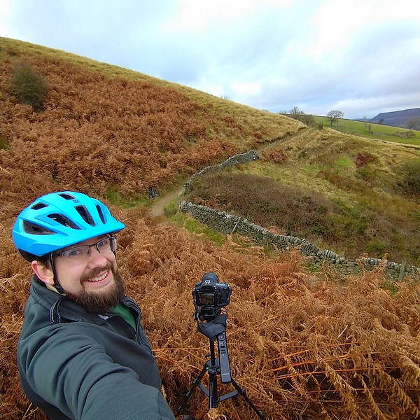
17 Oct, 2025, By: JeffGeneral, News, Site,
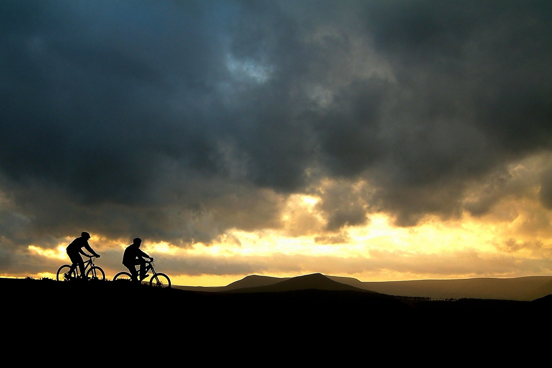
Monkeyspoon started 20 years ago as a website I created to practice my web editing skills during a time before social media and Instagram. It evolved into a platform for sharing our collective passion for mountain biking in the Peak District, as well as participating in races in nearby areas and beyond.
Over the years, Jeff and I, along with many others, have contributed content to the site. Although we don’t post new material frequently anymore, we decided to refresh the website because much of the trail and route information remains relevant.
We both still live locally and continue to ride, being founding members of Peak District MTB, which acts as a voice for mountain bikers in the region and helps with trail maintenance.
I, James, went on to start a local bike shop called Bike Garage, using my local knowledge to offer mountain bike rentals.
Many thanks to everyone who has contributed to the site’s content over the years, and to our visitors new and old.
James and Jeff – ‘The Web Team’
Monkeyspoon.com – Just Sharing The Ride
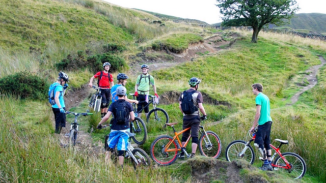
24 Nov, 2016, By: JeffSite, Tracks & Access,
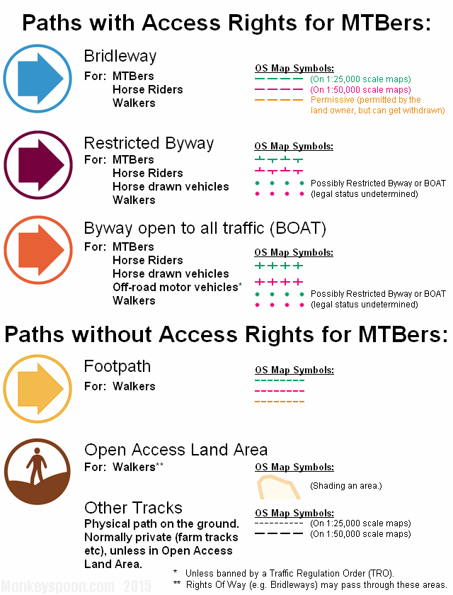
We recently* added the Mountain Biking in the Peak District Information page, that has some guidance on the type of paths mountain bikers can ride on in the Peak. It also covers maps and local bike shops.
*About a year ago really.
2 Jan, 2012, By: JeffSite, Tags: OS Map
![[11'09'18 OS Track Map v3 SS.jpg]](https://monkeyspoon.com/Pictures/SitePics/11'09'18 OS Track Map v3 SS.jpg)
https://monkeyspoon.com/peak-district-mountain-biking-route-map
We’ve (finally) updated the OS Tracks Map and the Route Designer (which was previously a beta version in a separate page). Hopefully we’ll be adding some more routes soon too.
New Features
- Integrated Route Designed
- Improved Routes & Route detail
- Mouse-over titles on marker icons.
- Share Route on Facebook link
- Shorter custom route sharing URLs
- Map area increased to include more of Sheffield
- New URL (Web Address)
- Updated Places & some new pre-drawn lines
- New More Flexible Back-end (stuff geeks get excited about)
We’ve also updated the Tracks page and added some new tracks and updated others:
27 Mar, 2011, By: JeffSite,
We have now moved into our new server, but unfortunately a few things fell off the back of the removal van on the way… Editors comment, as Jeff was driving!!!
Anyone who registered as new user after 02/01/2011 has been lost, so will need to recreate their account.
Any comments after 1/3/2011 have been lost.
Other than that we seem to be back as normal, but let us know if you see anything odd happening or stuff doesn’t work.
Thanks,
The Web Team
3 Jul, 2010, By: JeffSite, Tags: OS Map
![[OSmap Designer Beta SS]](https://monkeyspoon.com/Pictures/SitePics/10'07'03 OSmap Designer Beta SS.jpg)
A year and a half ago we unveiled a little OS map showing tracks for the Tracks page, now we bring you a Beta version of our route designer for mountain biking in the Peak District – with a twist!
Basically the idea behind it is that there are, relatively speaking, few places people would ride in the Peak District (compared to walking or driving), therefore instead of people constantly having to redraw routes and parts of routes, all the bridleways and joining road could pre-programmed into the map. This makes it possible to draw a very accurate route in a matter of minutes, that might take half an hour by the conventional method. To my knowledge no one else has done this for mountain biking routes.
So far most of the Hope Valley and north has been entered, the west of Sheffield and White Peak needs a lot of work. It works in Firefox and should would in Internet Explorer 7 & 8. This is a Beta version, so it doesn’t look very pretty and is by no means finished, please try it out and leave feedback as a comment below. It is currently separate from the main OS map, but once further developed they can hopefully be merged.
To add a pre-drawn track line (shown in semi-transparent grey) to a new route, simply click on it, a thin red line will appear down its length. The same goes for Tracks, shown in purple. Its ID or name will appear in the box in the sidebar, with the newest section at the top. To remove a section; click on its ID/name and then click the Remove Selection Line button.
To draw your own section; move the cursor to your first point, then (briefly) press the CTRL key, an orange cross will appear (this can be dragged around), repeat this to draw a section, once done click the ‘Lock Line into Route’ button.
Once you have your complete route, click ‘Generate Route URL’ then click the ‘Route Link’, this will display your route on the public version of the map (in another tab or window), to share this route select the URL from the new tab and copy & paste to where you want to share it.
Here’s one I made earlier


